 Zach
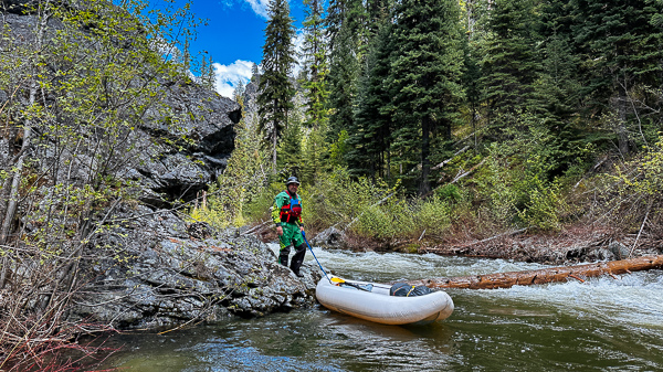
Collier: This is a trip I've been trying to do for many years but struggled to find a group to go when the flows are right. We launched at the NF-052 bridge at around 5,600 feet and enjoyed the clean, crisp air of the mountains. The Run started with continuous whitewater for the first few miles and then eased up a bit the rest of the way. We took our time so we could keep an eye for wood in the river and carefully portage around 8 logs we ran into along the way. The camping was wonderful and we didn't see anyone else while we were on the river. Camping at the confluence with Granite Creek was a highlight.
Zach
Collier: This is a trip I've been trying to do for many years but struggled to find a group to go when the flows are right. We launched at the NF-052 bridge at around 5,600 feet and enjoyed the clean, crisp air of the mountains. The Run started with continuous whitewater for the first few miles and then eased up a bit the rest of the way. We took our time so we could keep an eye for wood in the river and carefully portage around 8 logs we ran into along the way. The camping was wonderful and we didn't see anyone else while we were on the river. Camping at the confluence with Granite Creek was a highlight.
OWSR No. 50: North Fork John Day
- Flows through North Fork John Day Wilderness
- Largest chinook salmon an steelhead runs in the Columbia River watershed
- Diverse Geology
- Abundany rafting, kaykaing, camping, and hiking opportunities
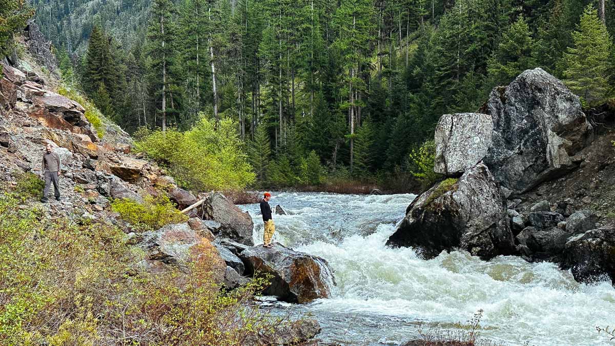
Scouting Granite Creek Falls on the North Fork John Day | Photo: Zachary Collier
Quick Facts
|
More Information |
Celebrated by Zach Collier, Yann Crist-Evans, and Doug Wiedwald on May 29-31, 2023 by kayaking through the North Fork John Day Wilderness.